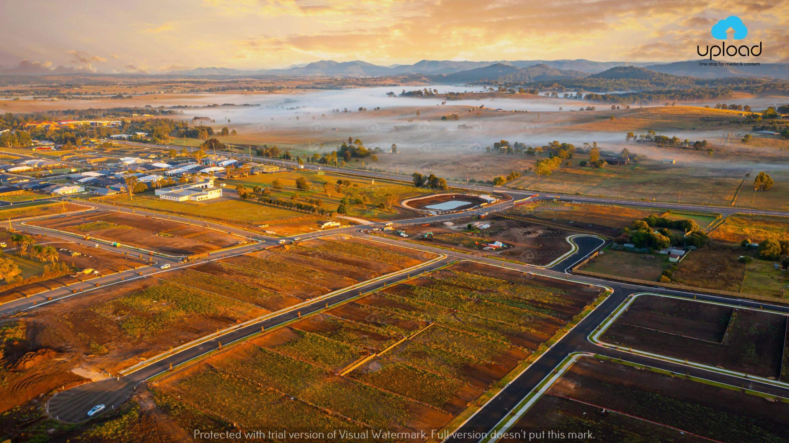
In recent years, construction drone mapping and data processing through mapping software has been crucial in improving efficiency and safety in the construction sites. Data processing through aerial survey of construction sites has been a revolutionary for the industry. On top of that, recent development of artificial intelligence, machine learning and data analytics has made mapping software incredibly powerful. And those who have embraced this modern technology have certainly benefited from this in various ways.
By capturing high-resolution aerial images and drone data, experts can generate 3D maps and models, volume calculations, roof inspections, accurate maps and much more. Moreover, with the help of drone flight it will also help in visualizing progress for all parties involved. Hence, seeing its importance for the industry, we here at Upload Media Services (Sydney-based photography and videography company) will help you explore more about construction drone photography. And why you should too consider hiring one for your business.
Drone mapping offers several advantages over traditional methods of site surveying and mapping. It allows for rapid data collection, real-time monitoring, and detailed analysis of construction sites. The use of drones in construction has significantly transformed the industry, enabling professionals to make informed decisions, streamline operations, and optimize resource allocation.
Drone mapping can offer several advantages over traditional methods of aerial survey and mapping techniques. This technique allows for the most accurate, real-time and detailed data which will be super beneficial for mapping and 3D modeling of the site later on. Furthermore, this technique also makes for easier data capture of a construction project with minimal use of resources at hand.
Drone mapping through the process of drone photogrammetry has revolutionized the process of site surveying and mapping by providing accurate drone data. Drones equipped with lasted and modern mapping and 3D modeling software along with high-resolution cameras and LiDAR sensors.
With these combination of these modern hardware and software, we can quickly capture detailed images and generate accurate maps, contour lines and digital elevation models. This data assists architects, engineers and construction managers in understanding the terrain, identifying potential challenges, planning construction activities and overall visualizing progress of the project.
Monitoring construction progress is crucial to ensure projects stay on schedule and within budget. Drones enable construction professionals to capture aerial images and videos at regular intervals, providing a comprehensive view of the site’s development. By comparing these visual updates, stakeholders can track progress, detect discrepancies, and address any issues promptly.
Safety is paramount in the construction industry. Drones equipped with thermal imaging cameras and sensors can conduct safety inspections more efficiently and effectively. They can identify potential hazards, monitor worker compliance with safety protocols, and assess the structural integrity of buildings. By using drones for safety inspections, construction companies can minimize risks and prevent accidents.
Tracking and managing construction assets and inventory can be challenging. Drones equipped with RFID (Radio-Frequency Identification) technology and advanced software can automate asset tracking and inventory management processes. They can capture data on materials, equipment, and supplies, ensuring accurate records and optimizing resource utilization.
Construction drone mapping relies on high-resolution imagery to capture detailed data of construction sites. Drones with advanced cameras can capture images with exceptional clarity and detail, allowing for accurate measurements and analysis. Additionally, drones can generate 3D models of the construction site, enabling stakeholders to visualize the project in a realistic and immersive manner.
Photogrammetry is a technique used in drone mapping that involves capturing overlapping images from different angles to reconstruct 3D models. By analyzing these images and generating point clouds, which are dense collections of data points representing the surface of an object or terrain, construction professionals can derive precise measurements and create detailed models for analysis and planning.
To process and analyze the data captured by construction drones, specialized software tools are used. These software applications allow professionals to stitch together aerial images, create 3D models, perform volumetric calculations, and generate comprehensive reports. Construction-specific software streamlines data analysis, simplifies decision-making, and enhances collaboration among project teams.
Construction drone mapping significantly improves efficiency by automating data collection and analysis processes. This gives it the ability to quickly capture accurate site data and generate 3D models. Which reduces the time required for traditional surveying and mapping methods. This increased efficiency translates into cost savings, as fewer resources are needed for data collection. Which will ultimately lead projects to progress more smoothly.
The use of drones in construction mapping ensures a higher level of accuracy and precision in data collection and analysis. Drones can capture detailed images and measurements that may not be easily achievable through manual methods. This accuracy helps in identifying potential design flaws, optimizing resource allocation, and minimizing rework, leading to improved project outcomes.
Drones provide an additional layer of safety in construction by minimizing the need for workers to access potentially hazardous areas. Instead of sending personnel to inspect elevated structures or confined spaces, drones can be deployed to collect data. This reduces the risk of accidents and injuries, improving overall safety on construction sites.
Construction drone mapping has emerged as a game-changer in the construction industry, offering numerous benefits in terms of efficiency, accuracy, and safety. By leveraging the power of aerial imagery, 3D modeling, and advanced software, construction professionals can streamline processes, make informed decisions, and achieve successful project outcomes. Incorporating construction drone mapping into projects ensures that construction companies stay at the forefront of innovation, delivering superior results to clients.
At Upload Media Services, we understand the importance of cutting-edge technologies in the photography and videography industry. As a leading provider of drone services, we offer comprehensive construction drone mapping solutions that help transform the way construction projects are planned, executed, and monitored. Contact us today to learn more about our services and how we can assist you in harnessing the power of construction drone mapping for your projects.

